Site location
Site location
The site lies to the south of Cuffley village and directly south of King George’s Vale development. It is bordered by KGV Playing Fields and Northaw Road East to the west, the railway line to the east, and Northaw Brook running to the south of the site.
Covering approximately 10 hectares (24 acres) of agricultural land, the site is within easy reach of local facilities, including Cuffley High Street, Cuffley Village Surgery, Cuffley Railway Station (with frequent services to London and Stevenage), Cuffley School, and local churches, all less than a mile away (15-minute walk).
There are several existing footpaths around the site, including the Public Rights of Way to the north (Northaw 006) and east across Northaw Road East (Northaw 009). The proposals will look to link into these routes, enhancing connectivity for pedestrians and cyclists.
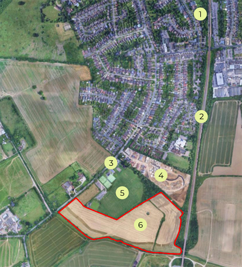
- 1Cuffley Station
- 2Railway line
- 3Northaw Road East
- 4Phase 1
- 5KVG Playing Fields
- 6Site location
Technical assessments
Key considerations and opportunities
We’ve carried out early technical assessments to understand what needs protecting and where new homes, paths and green space could go.
Key things to protect
- Northaw Brook and drainage corridors – maintaining suitable buffers to manage flood risk.
- Electricity pylons – no building beneath them; the corridor can be used for landscape, habitats and roads.
- Mature trees and hedgerows – retain where possible and strengthen with new native planting.
- Land levels – higher ground in the north and lower land to the south, informing building heights and layout.
- Existing routes and biodiversity corridors – retained and enhanced to improve access and connectivity.
Opportunities we are exploring
- Green corridors – multifunctional spaces for wildlife, sustainable drainage and informal walking/cycling.
- A central park at the heart of the site, with places to play and meet as well as new planting.
- Better walking and cycling links – connect to the Hertfordshire Way, local Public Rights of Way and King George’s Vale development.
- More habitats for wildlife – meadows, woodland and wetland features alongside sustainable drainage to support a measurable biodiversity net gain.
- Sensitive building heights and layout – stepping with the land to create a softer, greener edge to the village, and frame views towards Soper’s Viaduct.

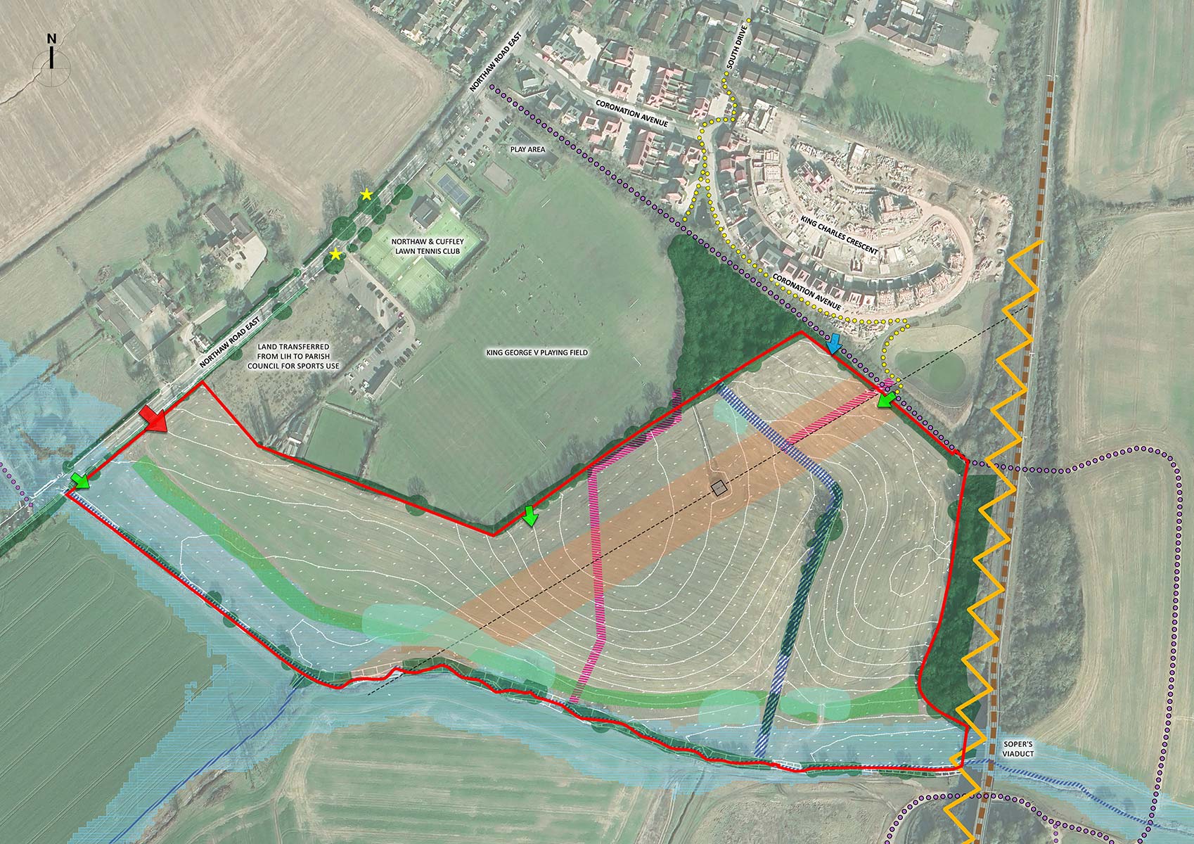
 Site boundary
 Proposed site access
 Potential secondary access
 Potential pedestrian access
 Existing overhead electric cables
 Existing foul sewer & easement
 Existing drainage ditch & Northaw Brook
 Existing public right of way
 Cycle & footpath
 Existing train line
 Noise buffer from train line
 Existing vegetation
 New landscape planting
 Electricity pylon
 Bus stops
 Flood zones 2/3
 Offset from overhead electricity cables
 Site topography
 Indicative drainage ponds
The site
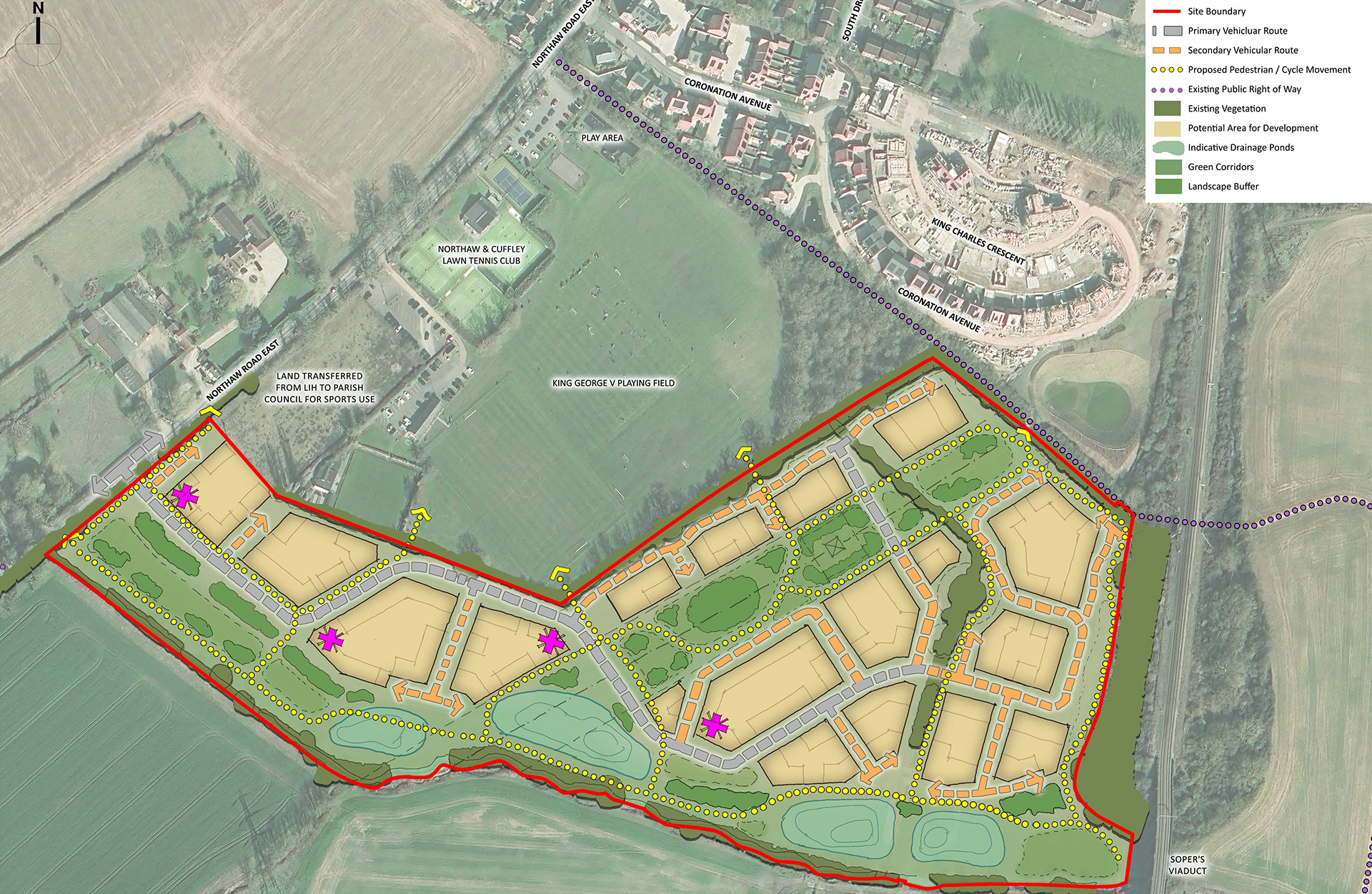
Initial framework plan
Following feedback received from the local community, stakeholders and Welwyn Hatfield Borough Council, the framework plan for the proposals has evolved.
The below framework plan establishes the overarching principles that helps guide the more detailed design of the development. These principles aim to support the delivery of high-quality, sustainable homes, generous and well-integrated landscaping and strong active travel connections to create a balanced and inclusive new community.