Proposals
A vision for Cuffley
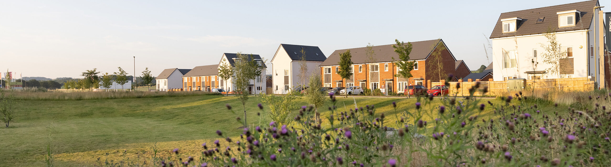
We are bringing forward plans for a new residential development that will provide a mix of up to 200 high-quality new homes, including 50% affordable, whilst investing in key local infrastructure and creating vibrant public open green spaces for everyone to enjoy.
Our vision is to create a landscape-led development that enhances the site’s existing features through the integration of sustainable drainage ponds, new hedgerows, tree planting and wildflower meadows.
Key features
Designed to meet the needs of the local community
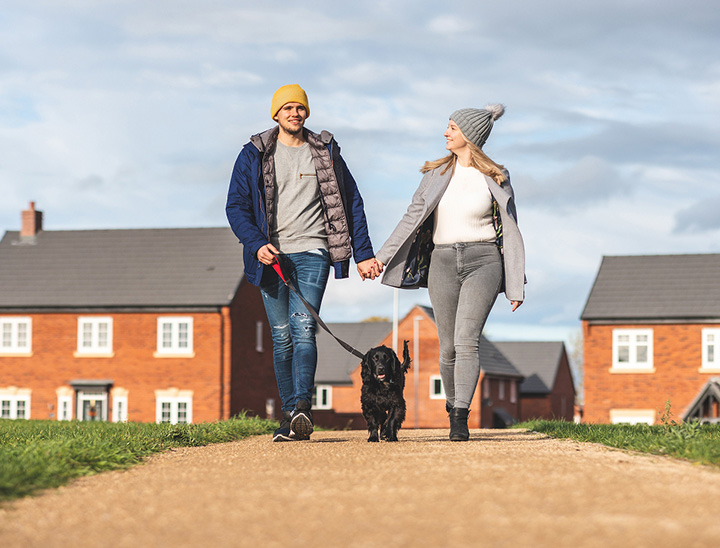
The site has the opportunity to deliver a number of community benefits, including:
- A mix of up to 200 high-quality new homes, forming a sustainable extension to the south of Cuffley, with a mix of sizes and types.
- 50% affordable housing, helping local families, key workers and younger residents remain in or return to the area.
- A landscape-led design incorporating new areas of public open space, including a play area, formal gardens and community growing spaces.
- At least a 10% biodiversity net gain through new planting, meadows and wetland features.
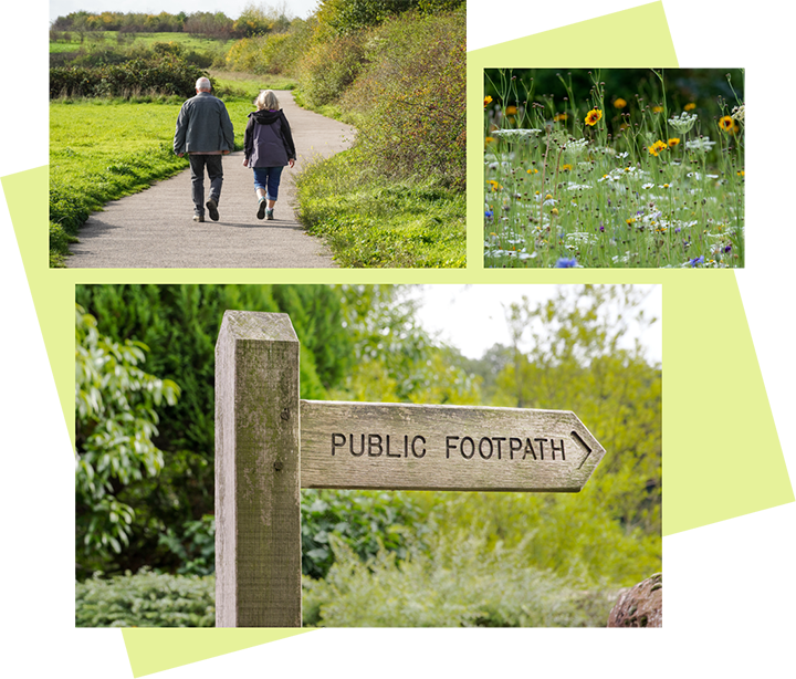
- New and improved walking routes and connections to existing footpaths and the wider village.
- Energy efficient homes, built to modern standards and equipped with electric vehicle charging.
- Financial contributions towards local infrastructure and community facilities.
The site
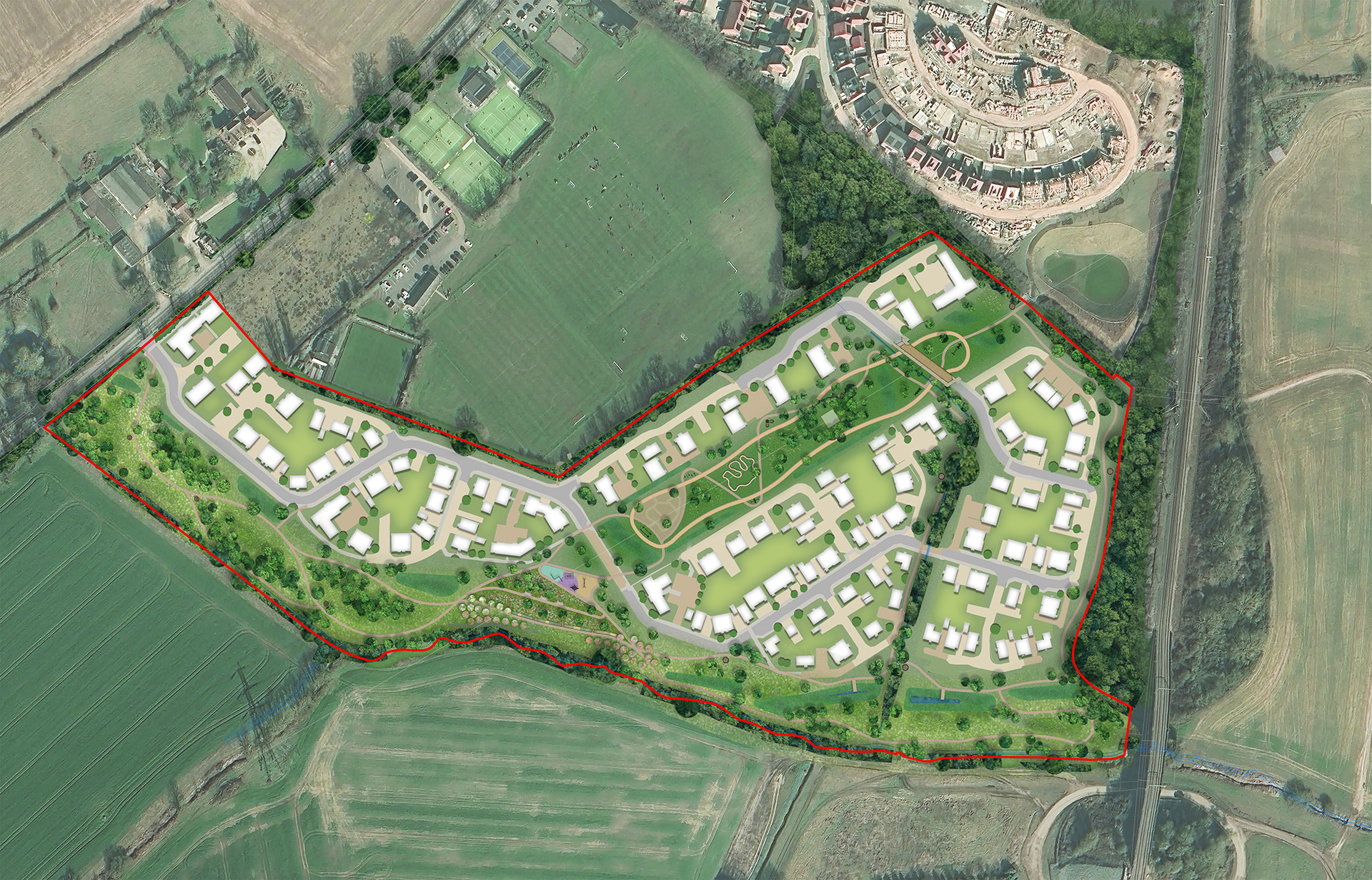
Proposed site layout
New homes
Meeting the housing needs of the local area
LIH is proposing to deliver up to 200 high-quality new homes to help meet the identified housing needs of the local area.
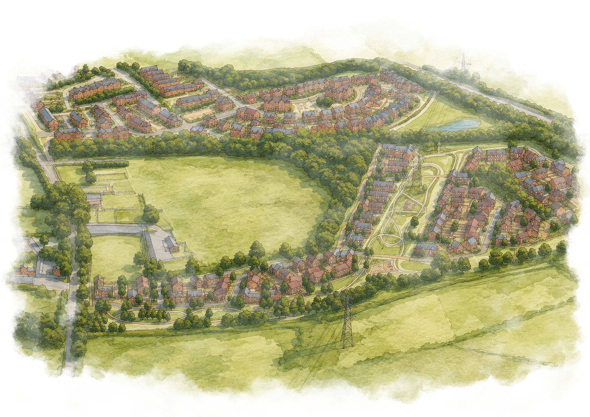
The emerging proposals have been designed across two residential parcels; one positioned the west, adjoining Northaw Road East and the KGV Playing Fields, and the second to the east towards the railway line. The areas are connected and defined by generous green spaces that retain and respond to the site’s existing landscape features, helping to create distinctive character areas across the development.
Given that this is an outline application, it seeks to establish the principle of the development, with detailed design matters to be considered through a future Reserved Matters application. The new homes will be designed to not only complement the local area but also to allow the development to establish its own distinct sense of place, helping create a community.
As part of the proposals, 50% will be designated as affordable homes including a mix of affordable rent, shared ownership and first homes. This will help provide opportunities for a wide range of people, including first-time buyers, growing families and those looking to downsize, while also supporting Welwyn Hatfield Borough Council in meeting local housing need.
Landscape and open space
Responding positively to the surrounding landscape
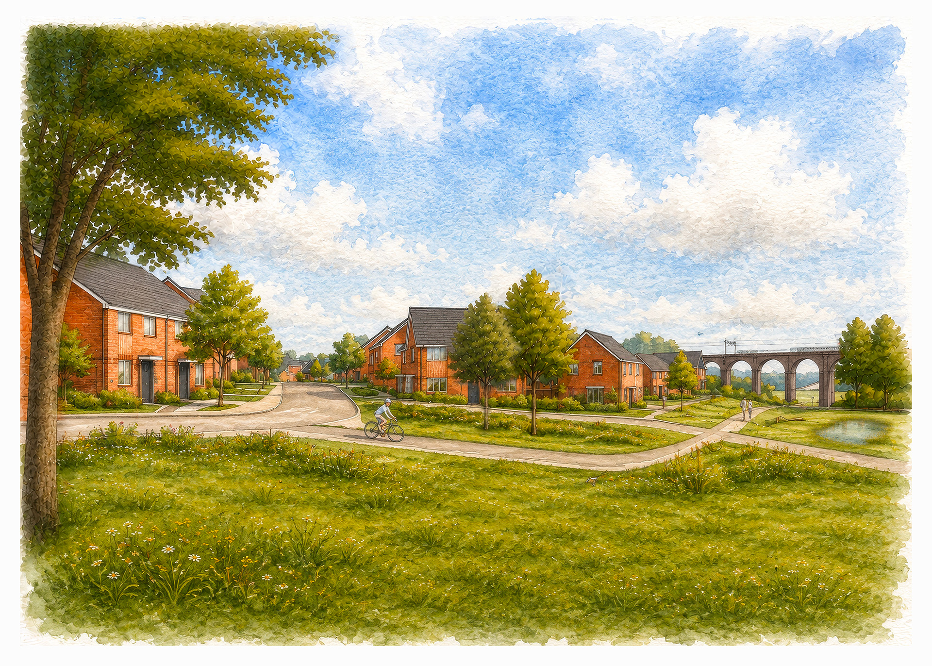
The surrounding landscape is integral to Cuffley’s character. Undulating landform, recreational routes and Soper’s Viaduct are key distinguishing features. The site sits alongside King George V Playing Fields and is bordered by established vegetation, the railway line and Northaw Brook. The Hertfordshire Way recreation route and a number of Public Rights of Way run adjacent and nearby to the Site.
The proposals respond positively to this setting by incorporating significant areas of landscaping and publicly accessible open space, achieving a minimum 10% biodiversity net gain, while responding appropriately to the character of Cuffley. The provision of safe, convenient and attractive pedestrian and cycle routes will improve access to Cuffley village and the surrounding countryside.
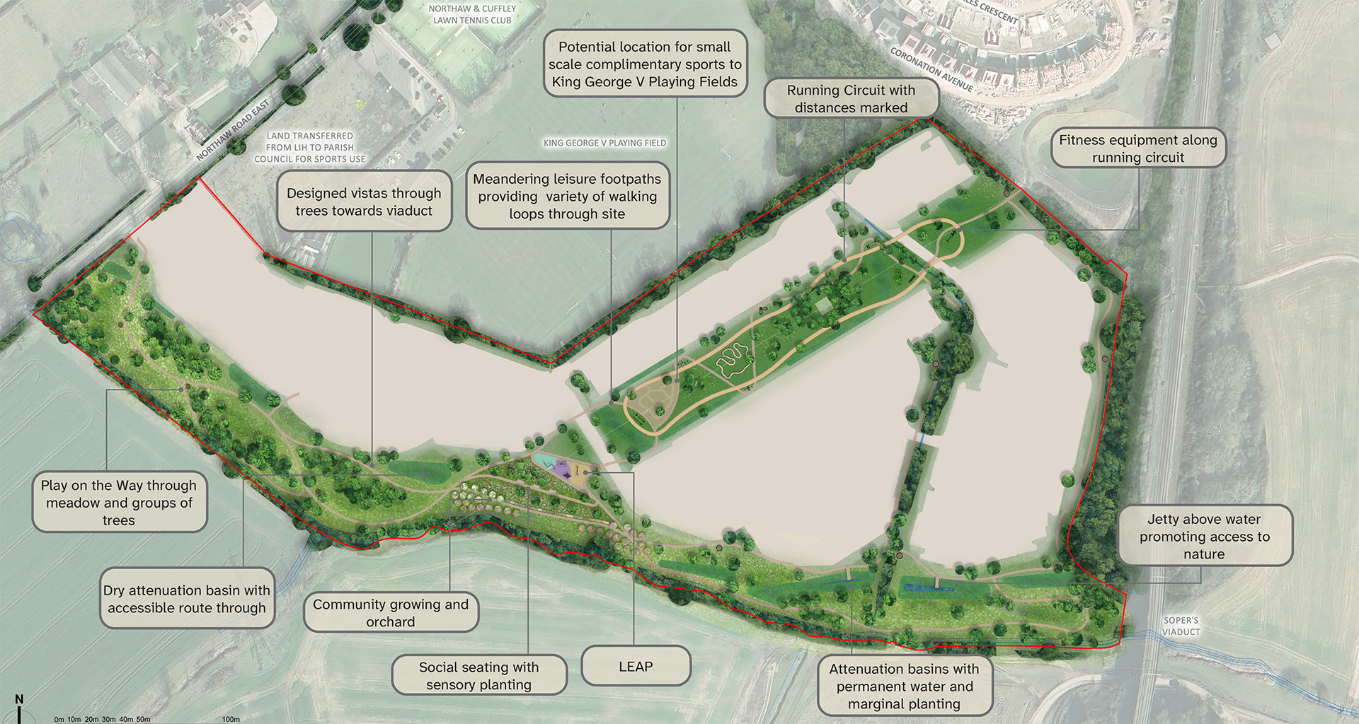
Whilst we have initially put forward what we think would be a good use of the open space on the site, we would love to hear your views on what should or could be provided in these spaces to ensure the area can be as useful and welcoming to existing and new residents as possible.
The proposals include:
- A central green space where residents and visitors can enjoy views towards Northaw Brook and the countryside beyond.
- A terraced landscape with play, social seating, sensory planting, orchard and community growing at various levels.
- A nature trail along the tributary of Northaw Brook, offering a quiet walk and opportunities to engage with nature.
- Connections to the wider landscape and Public Rights of Way via greenways with active travel routes.
- Meandering footpaths offering varied walking loops, with informal play woven through wildflower meadows and trees.
- A green corridor beneath the overhead power lines which could include a running circuit with marked distances, fitness equipment, a skate park or BMX pump track, supporting active lifestyles.
- Attenuation basins with seasonal water supporting sustainable drainage and wildlife.
- Boardwalks providing public access to the basins and connection with nature.
- Designed vistas through trees towards Soper’s Viaduct.
- New tree planting and landscape buffers softening the development edge and transitioning to the countryside.
Access and active travel
Encouraging walking, cycling and the use of public transport
Vehicular access to the site is proposed from Northaw Road East (B156). A new priority junction is being considered, designed to provide safe access into the development while maintaining appropriate visibility for vehicles entering and leaving the site.
Importantly, following feedback received during the first round of consultation, the proposed junction location has been repositioned further north to avoid existing trees and provide greater separation from nearby access points along Northaw Road East.
The proposals have also been designed to encourage walking, cycling and the use of public transport. The site is located on the southern edge of Cuffley, benefitting from access to the wider public transport network including the railway station and local bus stops in the area, with village facilities less than a 15-minute walk away.
We are also exploring the implementation of a 30mph speed limit along Northaw Road East, as well as improvements to the footway and existing bus stops, through conversations with Hertfordshire Highways. Notwithstanding, the junction will be designed in accordance with Hertfordshire Highway’s requirements to allow for vehicles to safely use the junction at existing speeds.
The development will include direct pedestrian connections to King George V Playing Fields and King George’s Vale, alongside links to existing footpaths and Public Rights of Way (PRoW), helping to improve access to nearby facilities and green spaces. As part of the proposals, we will also seek to improve the adjacent Public Right of Way to ensure it is usable all year round.
Green corridors and open spaces throughout the site will provide additional opportunities for walking and cycling, while the proposed internal layout will prioritise safe and convenient movement for pedestrians and cyclists.

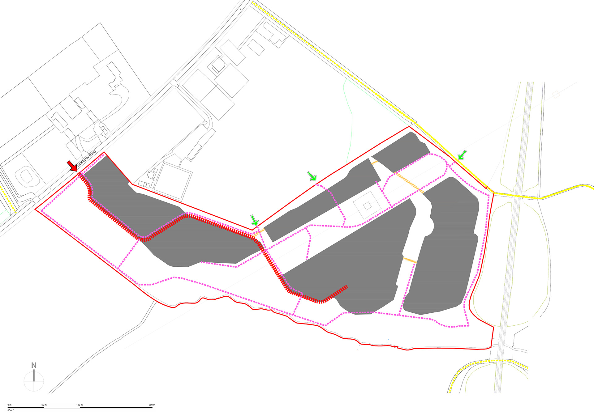
 Planning application boundary line
 Access points (all modes)
 Proposed pedestrian / cycle access points subject to agreement with King George V Playing Fields
 Existing Public Right of Way
 Indicative strategic pedestrian route
 Indicative primary access road
 Indicative vehicle crossing location between development parcel
Drainage
Managing surface water and flood risk
The proposals have been designed to effectively manage surface water and flood risk.
The majority of the site lies within Flood Zone 1, where flood risk is very low. A small area to the south, which slopes towards Hempshill/Northaw Brook, falls within Flood Zones 2 and 3 and will therefore not include any built development.
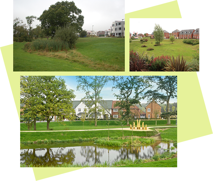
Sustainable Urban Drainage Systems (SuDS), including swales, landscaped dry basins and underground cellular storage, will be incorporated throughout the site’s landscaped areas, predominantly along the southern boundary to manage surface water while also enhancing green infrastructure and biodiversity. This means that surface water flows heading towards Northaw Brook will be slowed down, reducing flood risk on the site and further downstream. Basins will be naturalistic in their design, with planting to provide visual amenity and habitats for wildlife.
A Flood Risk Assessment will be submitted as part of the planning application to confirm appropriate site layout and drainage strategy.
Sustainability
Meeting the requirements of the Future Homes Standard
The proposals have been developed to align with the clear ambitions for carbon neutrality by 2050 set out by Welwyn Hatfield District Council, incorporating measures that supporting low impact living.
These include landscape-led design, biodiversity enhancement and active travel infrastructure, all of which contribute to reducing emissions and improving ecological resilience.
All homes will be designed to meet the requirements of the Future Homes Standard, delivering Zero Carbon Ready homes. This will be achieved through the application of the energy hierarchy and a fabric first approach which aims to reduce energy demand in the first instance, followed by the use of on-site renewable energy generation including ASHP and Solar PV.
Additionally, Electric Vehicle (EV) Charging Infrastructure is proposed, which will contribute to the scheme’s overall sustainability. There will also be provision for cycle storage to encourage the use of alternative modes of transport to the car.